
Status: Flood Warning
Road flooding
Thursday, April 6, 2023 (8:45 AM)
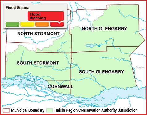
The Raisin Region Conservation Authority (RRCA) is issuing a Flood Warning for the RRCA jurisdiction. A Flood Warning is issued when flooding of infrastructure is imminent or occurring.
Yesterday’s heavy rains have caused the water level of streams and rivers to rise to their highest levels since spring 2017. However, damage from freezing rain has disrupted communication with several of the region’s stream gauges, leading to uncertainty regarding the current extent of flooding in the RRCA jurisdiction.
Rivers have risen and spilled their banks in many locations across the region. Some low-lying roads alongside rivers and creeks are flooded. These include:
- Sections of McGillivray’s Road between Martintown and County Road 27.
- Chapel Road, between the Beaudette River and Caber Road.
Overland flooding is also affecting many roads in the region.
Do not drive through floodwaters: Water can hide flood damage to the road, which could include washed-out sections of road. Strong currents can sweep vehicles off roadways.
No further rain is forecast for the next week. The rate of flow increase in waterways across the region is slowing, and it is expected that water levels will reach their peak today or tomorrow.
This statement is in effect until Saturday, April 8, 2023, at 4:00 PM. This statement replaces the Flood Outlook Statement issued on April 4. The RRCA will continue monitoring water levels and weather forecasts as part of the Flood Forecasting and Warning program. Updates will be provided as information becomes available.
For more information: Halya Petzold, Resource Specialist, 613-938-3611 ext. 244, floodforecasting@rrca.on.ca
Media contact: Vincent Pilon, Public Information Coordinator, 613-938-3611 ext. 229, vincent.pilon@rrca.on.ca
About Flood Forecasting and Warning in the RRCA
The Ontario Ministry of Natural Resources and Forestry (MNRF) is responsible for flood related emergencies. Flood forecasting and warning has been delegated to Conservation Authorities. If a local emergency is declared, MNRF will work directly with the municipality and in consultation with the Conservation Authority.
The Raisin Region Conservation Authority monitors precipitation and water levels throughout Cornwall, South Glengarry, and large portions of North Glengarry and South Stormont.
About Flood Forecasting Notices

Normal
No flood conditions exist.

Watershed Conditions Statement - Water Safety
High flows, unsafe banks, melting ice or other factors that could be dangerous for recreational users such as anglers, canoeists, hikers, children, pets, etc. Flooding is not expected.

Watershed Conditions Statement - Flood Outlook
Early notice of the potential for flooding based on weather forecasts calling for heavy rain, snow melt, high wind or other conditions that could lead to high runoff, cause ice jams, lakeshore flooding or erosion.

Flood Watch
Flooding is possible in specific watercourses or municipalities. Municipalities, emergency services and individual landowners in flood-prone areas should prepare.

Flood Warning
Flooding is imminent or already occurring in specific watercourses or municipalities.
In the event of a flood status of anything other than normal, the RRCA will issue a media release and advise our member municipalities.