
Status: Flood Watch
Flood Watch – Significant rainfall expected
Tuesday, April 4, 2023 (6:00 PM)
The Raisin Region Conservation Authority (RRCA) is issuing a Flood Watch for the RRCA jurisdiction. A Flood Watch is issued when flooding of infrastructure has not yet occurred but is possible under forecast weather conditions.
Significant rainfall is forecast for the RRCA jurisdiction. Forecast total rainfall amounts for Wednesday, April 5, and Thursday, April 6, range from 20-60 mm. Water levels in rivers and streams across the region are already high due to recent snowmelt and rainfall.
If significant rainfall occurs as forecast in the coming days, stream water levels across the jurisdiction will rise and could reach their highest levels since 2017.
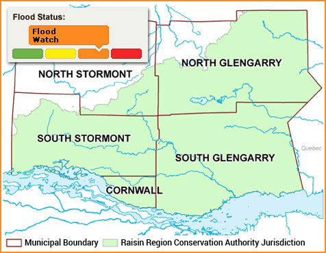
Across the RRCA jurisdiction:
- Worsened nuisance flooding of low-lying areas is expected.
In South Stormont :
- High risk of extensive flooding of the school yard immediately east of St. Andrew’s Catholic School.
In South Glengarry:
- High risk of flooding of the low point of Chapel Road, between the Beaudette River and Caber Road.
- Risk of flooding of McGillivray Road near Boileau Lane.
In North Glengarry:
- High risk of water backing up in areas typically susceptible to spring flooding downstream of Mill Pond.
- The water levels of Loch Garry, Middle Lake, and Mill Pond are being actively managed. Sudden increases in dam outflow may be necessary under the forecast weather conditions.
Residents in areas regularly affected by spring flooding should take precautions to protect their property, such as:
- Securing items that might float away as flows increase.
- Removing items from sheds, garages, basements, or lower floors that could be subject to flooding.
- Ensuring sump pump is clear, in good working condition, and has a backwater valve.
- Ensuring easy access to a portable backup generator and pump.
This statement is in effect until Saturday, April 8, 2023, at 4:00 PM. The RRCA will continue monitoring water levels and weather forecasts as part of the Flood Forecasting and Warning program. Updates will be provided as conditions change.
For more information: Halya Petzold, Resource Specialist, 613-938-3611 ext. 244, floodforecasting@rrca.on.ca
Media contact: Vincent Pilon, Public Information Coordinator, 613-938-3611 ext. 229, vincent.pilon@rrca.on.ca
About Flood Forecasting and Warning in the RRCA
The Ontario Ministry of Natural Resources and Forestry (MNRF) is responsible for flood related emergencies. Flood forecasting and warning has been delegated to Conservation Authorities. If a local emergency is declared, MNRF will work directly with the municipality and in consultation with the Conservation Authority.
The Raisin Region Conservation Authority monitors precipitation and water levels throughout Cornwall, South Glengarry, and large portions of North Glengarry and South Stormont.
About Flood Forecasting Notices

Normal
No flood conditions exist.

Watershed Conditions Statement - Water Safety
High flows, unsafe banks, melting ice or other factors that could be dangerous for recreational users such as anglers, canoeists, hikers, children, pets, etc. Flooding is not expected.

Watershed Conditions Statement - Flood Outlook
Early notice of the potential for flooding based on weather forecasts calling for heavy rain, snow melt, high wind or other conditions that could lead to high runoff, cause ice jams, lakeshore flooding or erosion.

Flood Watch
Flooding is possible in specific watercourses or municipalities. Municipalities, emergency services and individual landowners in flood-prone areas should prepare.

Flood Warning
Flooding is imminent or already occurring in specific watercourses or municipalities.
In the event of a flood status of anything other than normal, the RRCA will issue a media release and advise our member municipalities.