
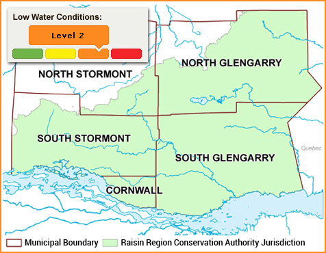
Status: Level 2
Recent precipitation is helping watershed conditions
Wednesday, August 17, 2016 (3:00 PM)
The last week has seen significant precipitation throughout the watershed. Our gauging station near Loch Garry in North Glengarry recorded 107.2mm of rain between August 9 and this morning. This is consistent with high precipitation amounts recorded by Environment Canada stations in Cornwall and nearby St-Anicet (Quebec).
The rain is a welcome relief to the watershed which was in a confirmed low level 2 drought condition as determined by the Ontario Low Water Response (OLWR) program.
At the end of July key precipitation gauges in the watershed had recorded 142mm less than expected precipitation for the previous 3 month period – only 43% of the norm.
The absence of significant precipitation had resulted in near record low lake levels in Loch Garry and Middle Lake; as well as extremely low flows in the Raisin River and virtually no flow in other major creeks, streams and tributaries. The recent precipitation has raised water levels in Loch Garry by 120mm, and Middle Lake by 144mm. The Raisin River has seen an increase in water level of 72mm, with the expectation being that it will continue to rise over the next day through continued runoff and groundwater flow.
The OLWR indicators will be reviewed again at the end of the month by the local watershed response team and any changes to the low water response level will be made at that time. The RRCA is still encouraging water conservation with a target of 20% reduction in water use.
Water Conservation Tips
• Repair any leaks in your home (e.g. taps and toilets)
• Reduce non-essential water usage such as lawn watering or car washing
• Only wash full loads of laundry or dishes
• Install a low consumption showerhead
• For farmers: monitor your irrigation systems for leaks, and consider irrigating closer to the evening to reduce evaporation loss
About Low Water Response and the RRCA
The Ministry of Natural Resources and Forestry (MNRF) manages water use during a drought. Ontario’s Low Water Response Program ensures provincial and local authorities are prepared in the event of low water conditions. The Raisin Region Conservation Authority assists the ministry by assessing local watershed conditions and notifying residents.
The Raisin Region Conservation Authority monitors precipitation and water levels throughout Cornwall; South Glengarry; and large portions of North Glengarry and South Stormont.
About Low Water Notices

Normal
Flows are in the normal range and precipitation accumulation has been close to average.

Level 1
Flows are less than 70 percent of their normal summer low flow and/or precipitation has been less than 80 per cent of average. Water users are asked to voluntarily reduce consumption by 10 per cent.

Level 2
Flows are less than 50 percent of their normal summer low flow and/or precipitation has been less than 60 per cent of average. The Ministry of the Environment and Climate Change will send letters to holders of Permits to Take Water to ask them to voluntarily reduce their consumption by 20 per cent.

Level 3
Flows are less than 30 percent of their normal summer low flow and/or precipitation has been less than 40 per cent of average. There is also potential for economic harm to water takers and/or significant harm to the ecosystem. The Water Response Team may ask the province to impose mandatory restrictions on those holding Permits to Take Water.
In the event of a low water status of anything other than normal, the RRCA will issue a media release and advise our member municipalities. A local Water Response Team will be convened to inform the MNRF and the public.
Useful Links
- Ontario's Low Water Response Program
- Ontario's Surface Water Monitoring Centre
- Water Smart - Protecting water from source to tap (PDF, includes water conservation tips)